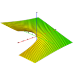
Everyone has seen a topographical map at some point during their life. In addition to the information that regular maps have, topographical maps typically show land features and elevation. How are these maps generated? Given that it's not possible to sample the elevation at every single point in the area of interest, we must use some sort of interpolation. To tackle this mathematically, we should make a few simplifications.
As you might agree, the Earth is round. However, if we consider the ...
Read More


